Mods/Silver's Soul/Route 46
Revision as of 23:13, 19 February 2013 by Blazer257 (talk | contribs) (Created page with "thumb|260px|Route 46 Map '''Route 46''' is a route in central-eastern Johto that connects to {{SS|Route 29}} in the south. == Points of interest == =...")

Route 46 is a route in central-eastern Johto that connects to Route 29 in the south.
Points of interest
Items
There are no items.
Pokémon
| Pokémon | Location | Levels | Rate Morning | Rate Day | Rate Evening | Rate Night |
|---|
For a list for all locations see: Pokémon Locations
Gallery
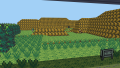
Part of Route 46.

List of Places. |
|
Kanto |
|
Johto |